Path#1: Montalceto
Explore the highest peak of the Crete Senesi
Come discover one of the historical sites in the Asciano area: the Montalceto promontory!
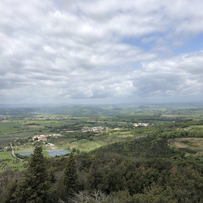
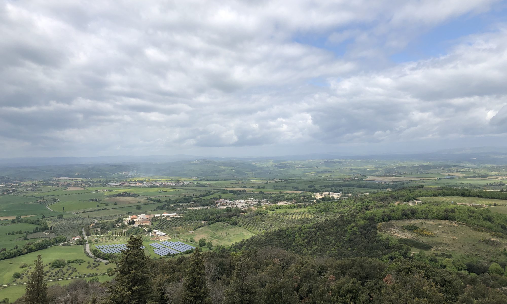
The route starts from the Asciano-Monte Oliveto Maggiore (MOM) Railway Station and will lead you along a trail that, after crossing the open countryside typical of the Crete Senesi, will take you into the more wooded area of the region.
What you’ll see along the route:
- The Necropolis of Poggio Pinci
This site consists of 10 tombs carved into the rock and was used by the Etruscans between the 5th and 1st centuries BC. The largest tomb contains numerous urns inscribed with the name of the family that owned the land: the Hepni. To learn more, visit the Palazzo Corboli Museum!The Montalceto Promontory
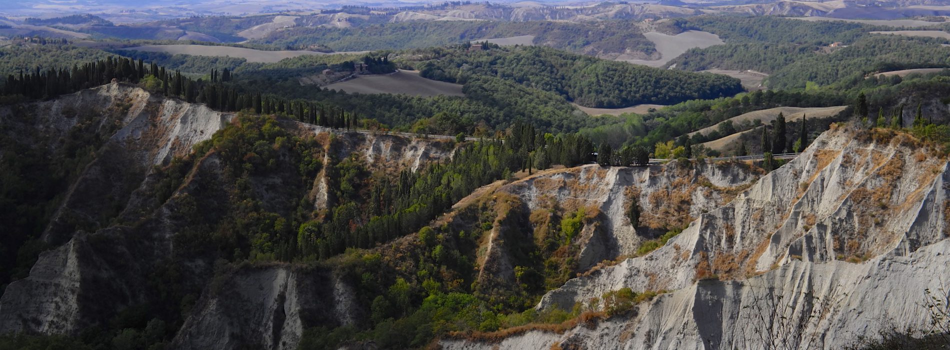
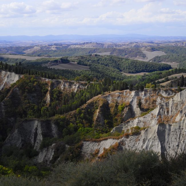
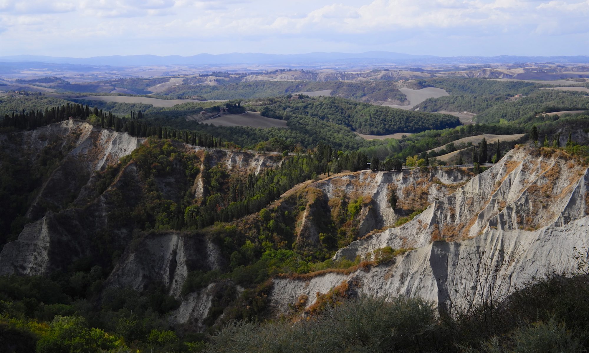
Before you, the highest peak of the region will open up: 488 meters above sea level. From the well-maintained olive groves along its slopes, you’ll enter the dense forest that hides two important monuments and the unexpected coastline of a very ancient sea!The Hermitage of Blessed Alberto
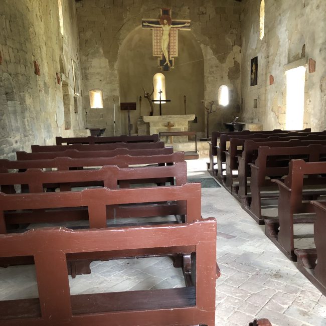
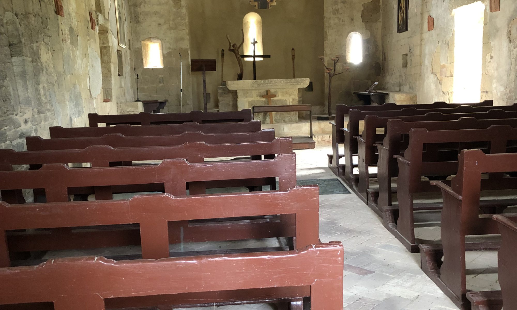
It is said in the "Camaldolese Annals" that in the first half of the 12th century, the hermit Alberto retreated here in solitude and decided to build this small church nestled in the woods.The Tower of Montalceto
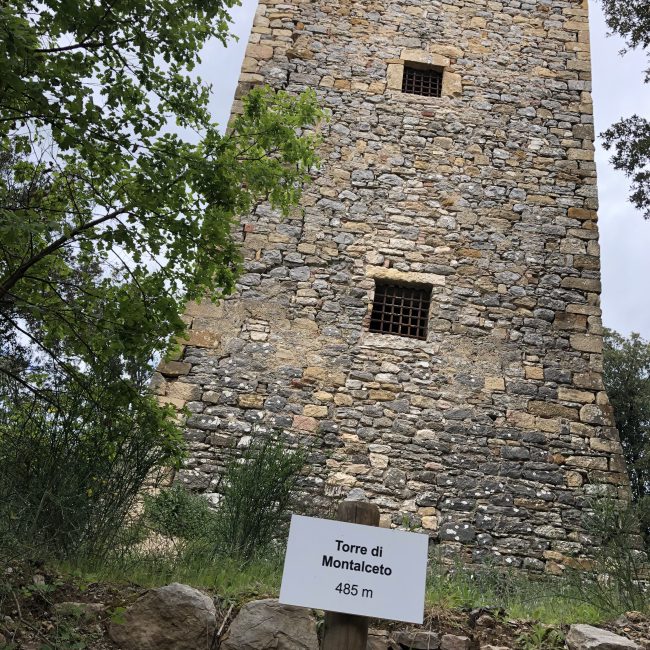
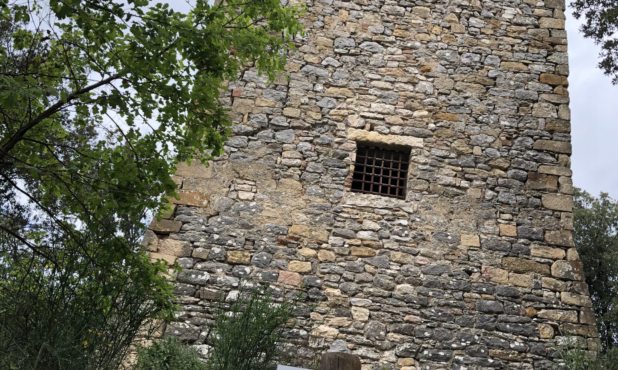
Built on the site of the ancient Montalceto castle (12th century), this 16th-century watchtower was commissioned by the locals to protect themselves from raids by armies and “aghuati di maschalzoni”!
Notes:
The Montalceto promontory is highly appreciated in the summer months because, thanks to its dense forest, it offers a respite from the summer heat. If you'd like to shorten the journey, bypassing the first section through the open countryside, you can drive to the base of the hill and then walk or bike the final kilometers in the shade of the forest!- The Necropolis of Poggio Pinci
Safety Guidelines:
- Choose routes based on your physical and technical abilities and gather information about the trail. Even though the trails are marked, be sure to bring an appropriate hiking map.
Dress in clothing suitable for the challenge and length of the hike, and equip yourself with essentials (water, sunscreen, hat, food, etc.) for emergencies, as well as a first aid kit.
Check the weather forecast and continuously monitor the changing conditions.
All Life Park routes are set in natural environments: traveling them means accepting the risks of outdoor sports. Enjoy NATURE!
- Choose routes based on your physical and technical abilities and gather information about the trail. Even though the trails are marked, be sure to bring an appropriate hiking map.


